

We are in the midst of a yachting weather forecasting and awareness revolution. With satellite internet technology today’s sailors have never had so much weather information available to them while sailing offshore. Here we will take a look at the new and traditional weather tools available to, hopefully, keep you a “fair weather sailor.”
Inshore
The weather forecasting game changer for those plying through coastal waters has come in the form of mobile devices capable of high-speed internet. Having weather on your phone might feel totally normal these days, but if you think about it, it hasn’t been that long that we have been able to watch approaching storm fronts or thunderstorms on a device that fits in your pocket. We will take a look at some of those mobile applications later in the article as they are applicable to both inshore and offshore transits, but first, we ask, “Where can you get weather reports while sailing near the shore?”
Marine VHF
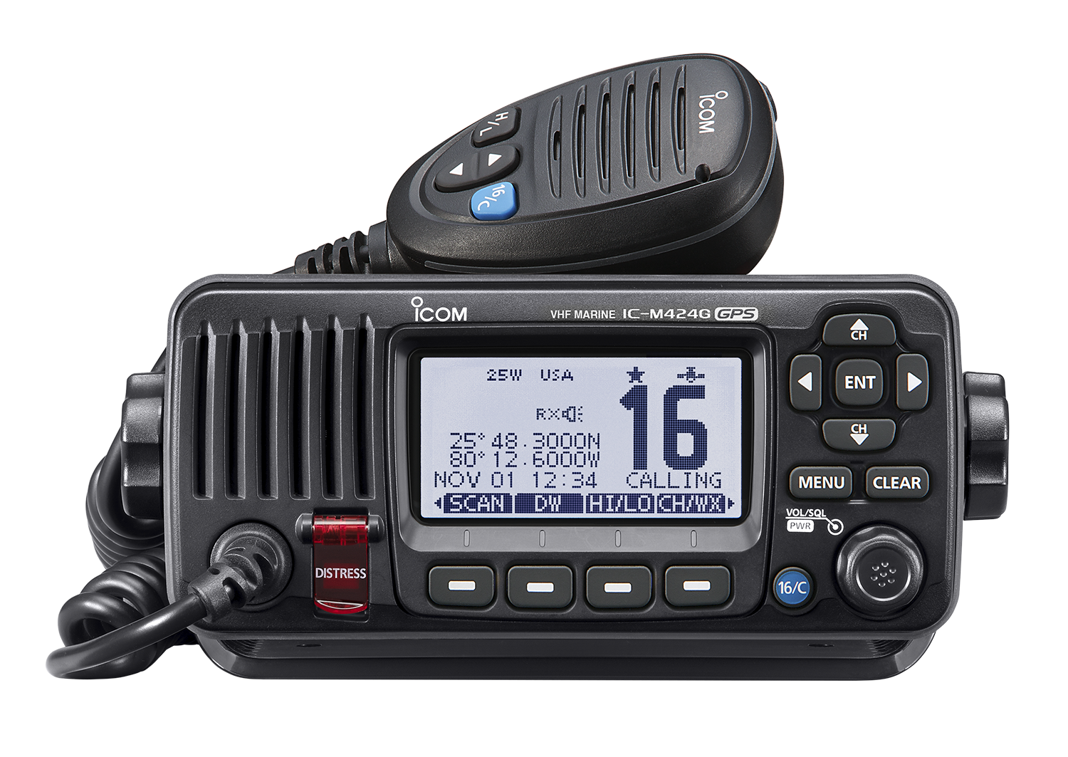
The weather band frequencies on the ubiquitous marine VHF radio used to be the primary way to gather weather information while on the water. From the professionals at the National Oceanic and Atmospheric Administration’s (NOAA) National Weather Service (NWS), NOAA Weather Radio (NWR) remains a great and critical source of weather information for mariners within around 25 miles of the coast. NOAA maintains a marine-specific NWR web page here.
Pros:
- Free, up-to-date weather broadcasts instantly available on your marine VHF.
Cons:
- Voice-only weather information feels a bit limited in this day of high-fidelity weather mobile phone apps.
- Offshore range of 25 miles.
- If you have one VHF, you will not be able to monitor frequencies or transmit while tuned into radio broadcasts. If you have a second VHF or a handheld VHF, it is recommended to use one for weather and one for comms.
Cellular Service
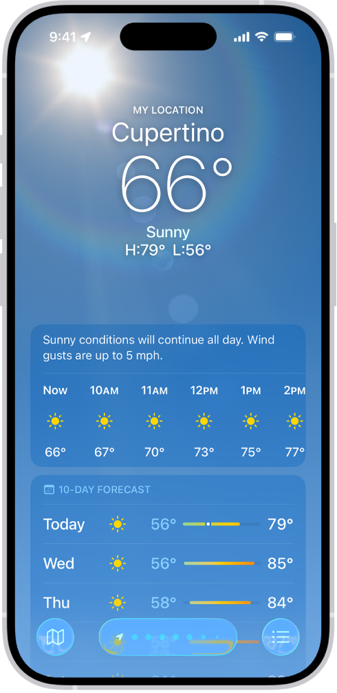
Your smartphone or cellular-connected tablet are now completely viable weather-data-gathering devices when operating on the water close to shore. With your smartphone or tablet, you can easily access weather apps and websites (see below) as long as you are within cellular range.
While cellular service does not extend out further than VHF signals, you can look at coverage maps provided by your service provider or this broadband service coverage map produced by the Federal Communications Commission (FCC). The FCC map allows you to view coverage areas by mobile broadband provider and service (4G LTE, 5G, etc.). Notice that coverage is not designed to extend offshore and reception is degraded once you leave land in most regions.
Pros:
- Access to a myriad of weather websites and apps on your device while you sail.
Cons:
- Limited signal range once you head out from shore.
Offshore
For years, and in the not-so-distant past, mariners relied on single sideband (SSB) high frequency (HF) “shortwave” radios to receive broadcasts with weather information. A properly tuned SSB could receive voice weather broadcasts as well as data broadcasts that could be presented on a weather fax paper printout or, in more recent times, on a computer screen.
Oh, how things have changed in the last few years.
Satphones

Satellite phones like Iridium and two-way satellite messaging tools like the Garmin inReach are able to receive weather information while offshore. Iridium’s voice capability allows users to converse with forecasters or listen to verbal weather broadcasts. Both systems allow reception of weather data files—GRIBs—that then can produce visual weather charts—see “The Importance of Sea State in Weather Planning.” Some inReach transceivers pair with a smartphone to deliver the weather information.
Pros:
- Worldwide coverage.
- Handheld, portable systems can move with you from boat to boat/location to location.
- Text and voice communication options.
Cons:
- Subscription needed.
- Limited bandwidth restricts speed and depth of weather data and information.
SiriusXM Weather
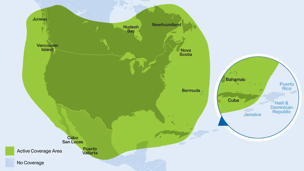
Several brands/models of chartplotters feature integrated SiriusXM satellite weather that allow you to view weather radar images, forecasts, weather maps, and more via a subscription service. SiriusXM offers both limited coastal and more comprehensive offshore/fishing weather services. The offshore plans advertise coverage for up to 150 miles off the coast.
Pros:
- If you have a compatible chartplotter, the weather information is delivered on the device you are already using for navigation—delivering weather information right to your helm or nav station without needing additional devices.
- You can add SiriusXM “radio” to your marine subscription at a reduced cost and enjoy smooth yacht rock tunes while you sail.
Cons:
- Subscription required.
- Designed for 150 nm offshore max.
Satellite Internet
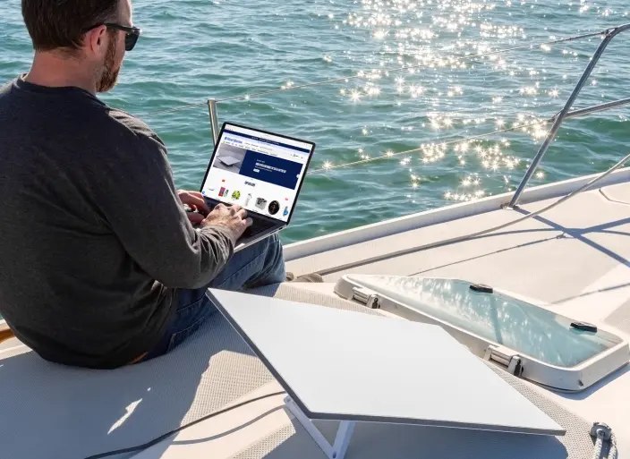
Starlink satellite internet, now facing competition from Amazon’s Kuiper and other startups, has been a game changer for offshore weather forecasting while underway. These subscription-based systems, in the simplest terms, give you high-speed internet access on your vessel while underway—broadcasting data on a WiFi signal throughout your vessel—providing access to any web-based weather websites and applications you desire while underway offshore.
Pros:
- Access to all internet-based weather information.
- Using the WiFi signal on your boat, you can access information on a smartphone or tablet anywhere in the vessel.
Cons:
- Subscription required.
- Installation requirements include an antenna and base unit and power needs.
- Antenna alignment may be difficult in a seaway. Some Starlink users have designed their own gyrostabilized mounting systems and some have reported success hand-holding the antenna and manually aligning it.
SSB
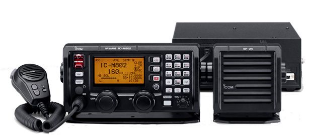
Tried and true, the SSB radio receiver or transceiver and weather fax is still an effective way to collect weather information while underway—inshore and offshore.
SSB radios come in two basic flavors. SSB transceivers allow you to both receive and transmit long-range radio signals. They are usually larger than a Marine VHF and require specialized antenna installation/setup and a ship station radio license if used to transmit. Portable SSB receivers can be the size of a small AM/FM radio and can be battery powered.
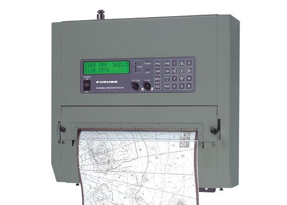
While you can find a new paper weather fax printer on the market today (looking at you, FURUNO), several companies offer “paperless” options with laptop software for the presentation of weather maps and data (again, like this FURUNO) and standalone units like the Steamrock SR-97 Weather FAX / RTTY / NBDP Receiver. For other weather fax software options, NOAA directs users to this DX Zone website.
Delivering weather fax with another modern twist, you can use an SSB receiver (even a portable/battery powered model) and play the audio weather fax signal to your smartphone or tablet. An offline app (HF Weather Fax is one) on your device “listens” to the radio signal from your speaker, translates the sound into the weather report, and presents it on your device.
Pros:
- SSBs transceivers are a great long-range distress transmission device for offshore sailing and tie into the Global Maritime Distress and Safety System (GMDSS).
- Weather fax data is free and transmitted over the airwaves to anyone with a receiver—no subscription required.
- Worldwide coverage.
Cons:
- Sailors need a SSB radio and printer or computer interface.
- Today’s SSB radios are fairly user-friendly and advanced, but there still can be an art to the science of receiving long-range radio transmissions.
- Weather fax information offers less visual fidelity than some apps and weather websites provide.
- SSB transceivers allow free voice communications for keeping in touch with other radio users.
Weather Apps and Websites
Assuming you are armchair sailing, on a near-coastal voyage with internet mobile coverage, or have a satellite internet system on your boat, there are a number (always growing) of incredible weather apps and websites available for your smart device or computer.
NOAA NWS Marine Weather Forecast Website
With internet on our mobile devices and a connection to the web, we can surf to the NOAA NWS Marine Weather Forecast Website and take a look at local marine forecasts for your area or other regions before you depart and while underway. On the forecast pages you will see textual information similar to what is broadcast on the VHF frequencies. NOAA NWS offshore weather information is available here.
Of course, with a good connection, the entirety of the NWS website is at your disposal for looking at radar images, weather maps, and more.
Pros:
- Access to an incredibly deep weather information resource with almost every weather reporting and forecast tool available.
Cons:
- Internet connectivity needed.
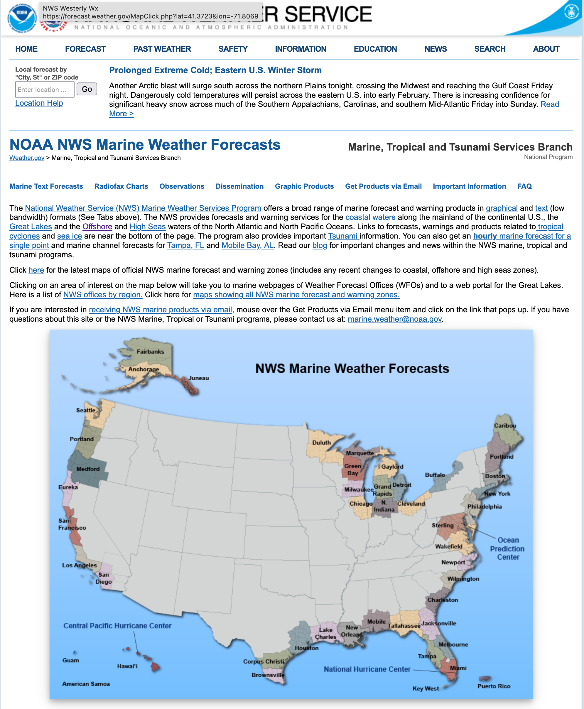
While not always as visually slick or user-friendly as some of the apps/sites we are about to look at, we need to promote the NOAA NWS. The NWS website is where most of the weather apps and sites we use pull their raw data from. Then they either regurgitate it with enhanced visuals or apply different models to the data and then present their information. If you want the weather “from the horse’s mouth” presented in a no-frills manner the NOAA NWS is your weather destination.
Having said that, we humans all like shiny and cool weather data on our glowing rectangles. Lucky for us, the internet is here to give us the goods! Far from a comprehensive list, here are some that are popular with boaters and worth exploring, if you haven’t tried them before:
App + Website
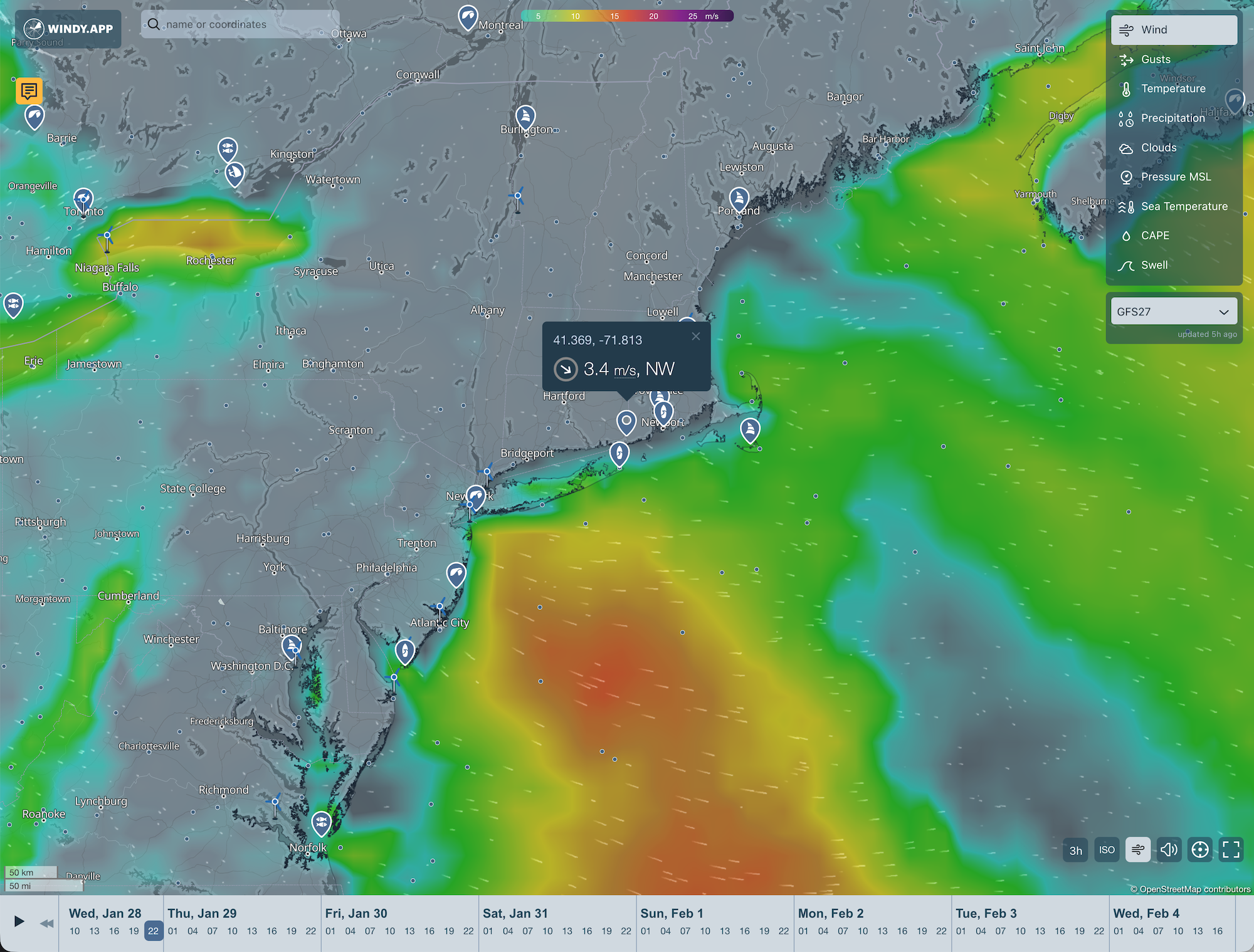
Windy
Professional weather app, created for water and wind sports and all outdoor activities with a detailed online 10 day weather forecast, live worldwide wind map, and local weather reports from the most accurate weather models. Premium features are available for a fee.
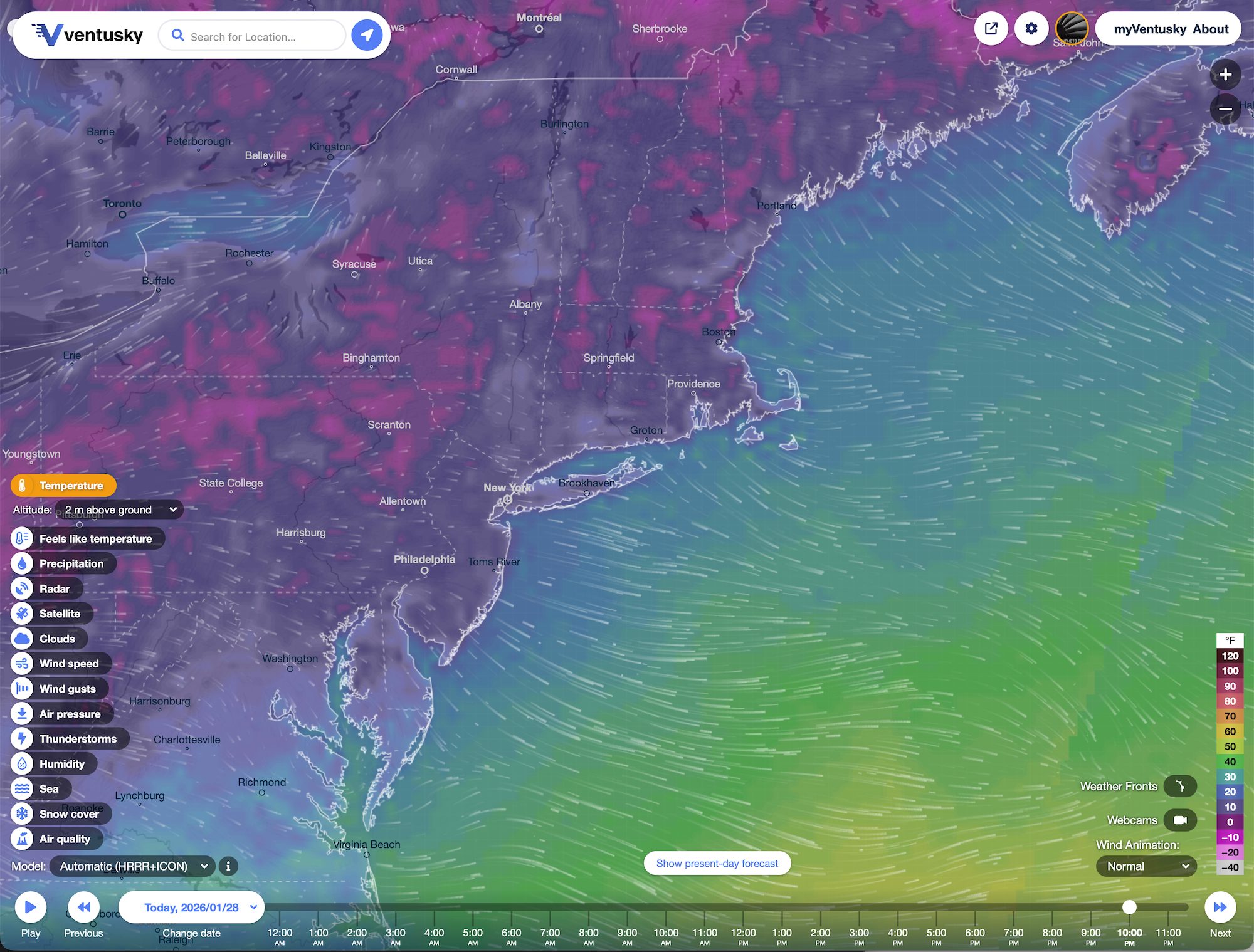
VentureSky
Weather app aimed at improving awareness about meteorological events in our atmosphere showing wind, radar, precipitation, and a lot more. Premium features are available for a subscription fee.
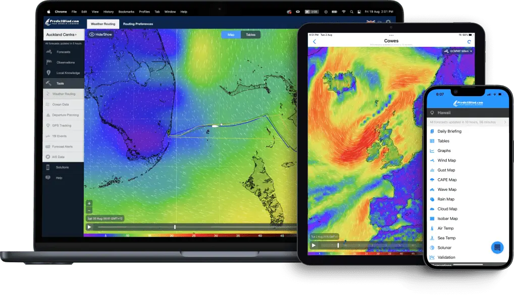
PredictWind
Subscription-based web and mobile interface that provides weather routing, departure planning, weather alerts, and live weather services. Also includes a free GRIB viewer for looking at weather data files.
BuoyWeather
Marine forecast app and website for fishing and boating with premium services available for a fee.

Apps
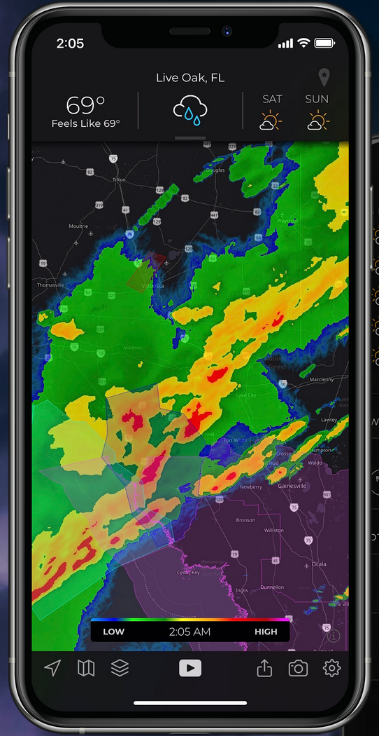
MyRadar
MyRadar provides an extremely fast way to get an overall at-a-glance, high-definition radar weather with various overlays and weather alerts.
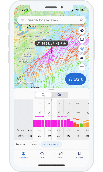
Savvy Navvy
Marine charting app with AIS, trip planning, weather routing, and weather charts.
Websites
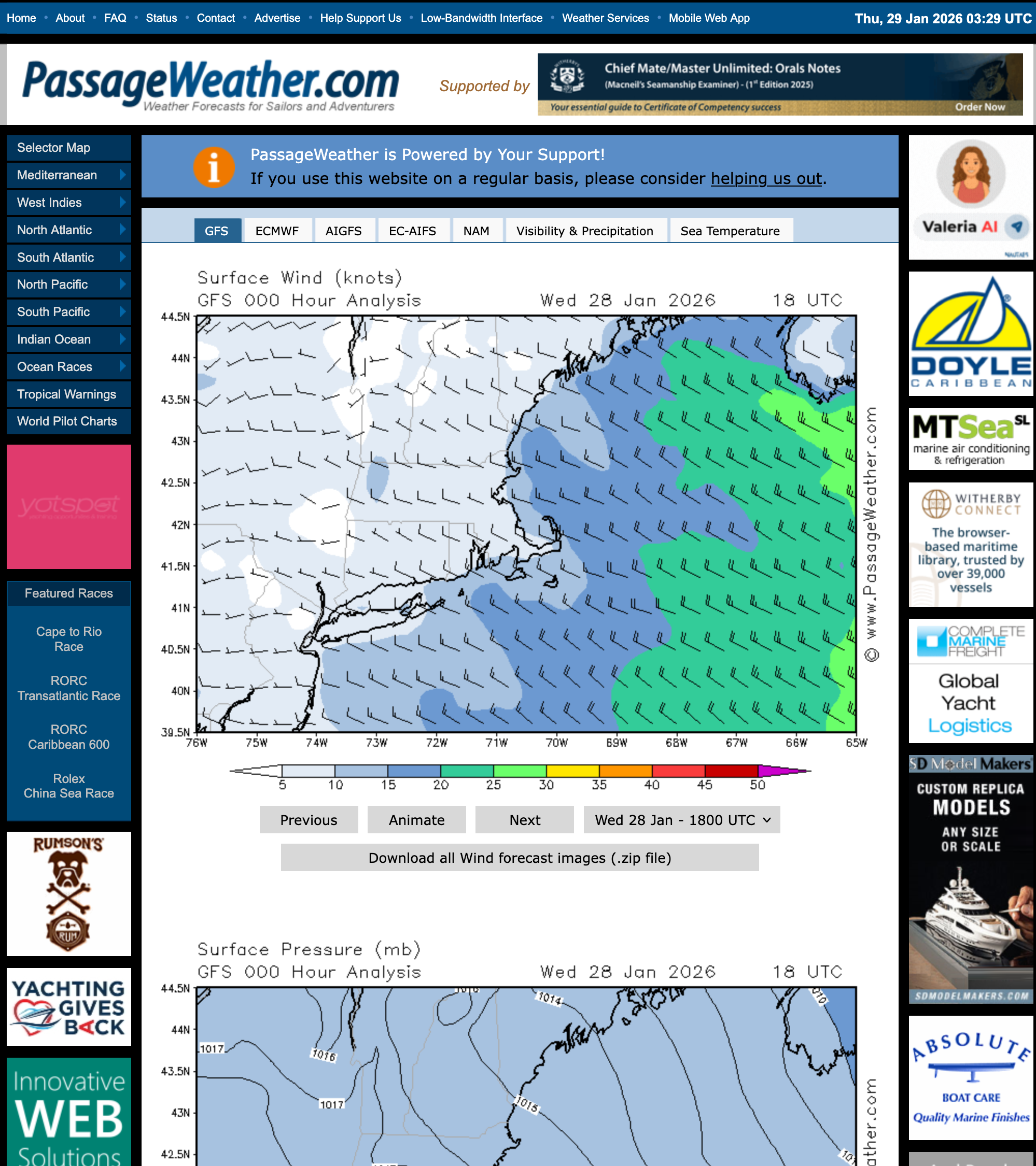
PassageWeather.com
Comprehensive marine weather website that specializes in sailing weather forecasts.
Forecasting Services
Almost all of the above weather services and information sources require you to do some of the weather guessing. Seeing isobars, fronts, wind barbs, sea state info, and more is great, but predicting what is coming next requires some knowledge of weather systems—knowledge that even those with advanced academic degrees in meteorology can, and sometimes do, misread.
If you are heading offshore and aren’t confident in your ability to read weather charts or predict weather accurately, there are a number of specialized weather forecasting services that can, for a fee, deliver personalized weather forecast information to your vessel via email, voice calls, or data files.
- Weather Routing Inc.
- Sailing Weather Service
- Locus Weather
- Marine Weather Center
- Commanders’ Weather
- Ocean-Pro Weather & Routing for Yachts
What Do You Use for Weather Forecasting?
Practical Sailor would love to hear from you on this topic. What are your favorite weather smartphone apps? What websites do you canvass before heading offshore? Are you using Starlink while underway to get internet and weather? Are you rocking an SSB and weatherfax? And, have you had experience with professional forecasting services that you would like to share?
We are only scratching the surface in this article and would love to gather more firsthand experiences in the comments section below.
Note: If you’re leaving a comment, please do not include any clickable links as the comment will automatically be set as pending.


Is there a HF weather app for Android?
Hello Rod!
Thanks for your question. I found one here: https://hf-weather-fax.en.aptoide.com/app
According to forums, there might be more…definitely worth a Google!
Good luck and thanks for reading!
Best,
Todd
This article is remiss for not identifying a barometer as a source for predicting weather. Barometer readings are prime indicator of impending weather. Barometers are not expensive, do not require batteries and are completely reliable. There are barometer apps that work on Apple devices without an WiFi or cellular connection. On my vessel there are three barometers and I check the readings the change of every watch. Never surprised by bad weather.
Hi Donald,
You make a great point here as I was focused solely on electronic means of getting weather reports.
Along with the barometer, I also realized that I forgot to mention keeping a “weather eye” on the horizon!
In the absence of electronic weather-getting devices, the barometer is certainly the most reliable old-school way to “sense” approaching weather.
Thanks for reading and commenting!
Best,
Todd
Luckgrib is a terrific app for downloading various GRIB files and providing weather tracking using numerous parameters.
Thanks for reading and sharing that info, Jack!
Best,
Todd
I used to use an Iridium Go! to (slowly) download grib files. It was a game changer. The game changed again with Starlink and now I use it primarily with Windy. I am tempted to try PredictWind as it seems to offer many useful features, but I am not a fan of subscription services (SaaS models).
Good stuff! Thanks for reading and sharing your experiences, flyfast2002!
Best,
Todd
SailFlow enables targeting specific locales, provides hourly data including seascape. I’m happy with the free version.
Nice! Thanks for reading and sharing your experience with SailFlow, Ronald!
Best,
Todd
OpenCPN has a great weather routing plugin, that uses GRIB files (for shorter term forecasting) or historical weather data (provided by the Climatology plugin, for longer term forecasting). Superb functionality, at an unbeatable price (free!)
Free is always the right price! Thanks for reading and sharing that option, Pierre!
Best,
Todd
Capt Farmer
Inland, I use Predict Wind on a tablet.
Offshore, I use StarLink plus Predict Wind and NWS.
Bad weather is the most likely thing to spoil your cruise.
Hi John,
Thanks for reading and sharing!
“Bad weather is the most likely thing to spoil your cruise.”…and a picnic!
Best,
Todd