Photo courtesy of Robert BurnPhoto by Al HerumPhotos courtesy of Joan Hildal
332
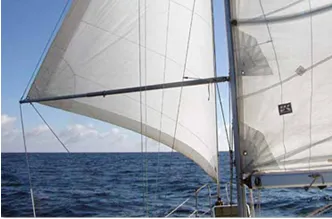
I so agree with Webb Chiles’ letter in the February 2012 Mailport and his “think of yourself as a sailor” comment. But every day on the water, the sailor will see lovely yachts with elegant lines and tall rigs motoring with a fair wind. What is wrong here? Why?
I can identify two practical reasons. One: Downwind rigs: All our lovely sailboats are designed to sail upwind. But we are gentlemen; we don’t like to go to weather! As soon as we bear off—once past 140 degrees off the wind—the jib collapses, then the boom comes up against the shrouds. So in addition to the 90-degree arc to windward, there is an 80-degree arc with the wind behind that is not comfortable either. And 90+80=170 degrees, almost half the possible courses with a given wind direction. No wonder people are motoring!
If you don’t want to motor, or gybe-tack for miles, you need an efficient controllable rig that will allow you to sail fast and safely dead downwind. You need a sturdy whisker-pole, so you can run wing-on-wing. This rig is powerful and stable. It can be handled safely by one person. Forget the extra diesel tank, spend the money on a sturdy downwind rig.
For many cruisers, learning to sail well never reaches the top of the agenda. But you cannot learn to sail on a big boat. You get this skill by sailing a dinghy round the buoys over and over until the relationship of wind and rig and rudder is subconscious. Once you have it, the responses of your big boat will be laughably slow, you’ll be able to surf your 40-footer downwind like an F-J while your crew cooks up crepes down below all unawares.
Robert Burn,
Neuromancer, C&C 30
Brisbane
You make a good point about needing downwind sailing ability. Wing and wing is great in tradewinds, but it’s not an effective light air-tactic. The best solution is having a rig, sails, and hardware that let you sail in all conditions.
Photo courtesy of Robert BurnPhoto by Al HerumPhotos courtesy of Joan Hildal
332
As you have written in your coverage of the 2011 sailing accidents, it can be difficult to release a tether when a PFD vest is inflated. Rock climbers have a similar problem; when rappelling with fall or winter clothing, they must extend the attachment of their rappel device to avoid sucking in clothes, which can be very dangerous. Clearing such jams has resulted in falls, as clearing the jam while hanging is quite difficult.
A simple retrofit for existing PFDs is to simply cow-hitch a short sling to the harness attachment point. Either the 6- or 12-inch should work well. You can cow-hitch a rappel ring or strong stainless ring to the other end for smoother clipping and release. You can find one on www.rei.com; search for Bluewater Titan/Spectra Runner; cost is $13.)
For a better-designed PFD/harness, I would suggest extending the clip-in point with webbing sewn in the style of a climber’s quick-draw. These have added stitching that stiffens the sling and makes it easier to handle and clip to fixed anchors while climbing. The quick-draw would have a ring sewn in and would be secured vertically to the harness when not in use. (For an example, search www.rei.com for Petzl Express Runner.)
Drew Frye
PDQ 32
Vienna, Va.
For many reasons, PS does not condone modifications for essential safety gear, but if one were concerned about the ability to access a tether’s quick release when the PFD/harness is inflated, this seems like an option. Key point: A load-rated D-ring where the tether snap-shackle or snap hook attaches would be important, as the strop loop alone could lock down on the tether hook or hardware when it is under load. In either case, you will want to practice detaching with your PFD/harness inflated. The initial feeling of tight constriction when the PFD inflates, especially if you are wearing clothes under the PFD/harness, can be almost as startling as the recognition that you are no longer on the boat.
My son turned me on to a neat app called MarineTraffic.com for Android phones. It’s based on the AIS system, and once installed, shows any vessel with AIS on your smart phone in real time. Ships are identified by name with heading and speed. It also shows where it’s been and where it’s going, the specs, and even the captain in some instances, plus the MMSI number and photos.
On the south shore of Long Island, we frequently race our Catalina 42 in the ocean. The buoys are far between, so sometimes, we use anchored ships as our turning marks. Knowing the heading and speed of approaching commercial vessels can be very useful. Giving you photos to help identify each ship in a crowded harbor or inlet is a bonus. And did I mention it’s a free app?
It works anywhere (from anywhere). It’s also great for trip planning to see how crowded a commercial harbor is.
Fred Schenker
Fortysomething, Catalina 42
Harbor Isle, N.Y.
I have enjoyed your recent coverage of iPad navigation apps (PS, February and March 2012), and I currently use Navionics with good results. I would like to see a discussion of how to network sail instruments and GPS data with the iPad via wireless signal in the absence of a PC or Mac. I understand there are several devices that will send NMEA 0183 and 2000 data over Wi-Fi (e.g. Brookhouse & SeaSmart). Do you have any experience with these devices? Is it easy to setup and integrate with iNavX, and does the network’s position data over-ride the iPad’s own GPS, enhancing accuracy?
Rob Boeckh
Charlie, 1978 Ericson 34T
Victoria, B.C.
We plan to test these devices in the future, but the technology is still evolving. There’s a good discussion of this on www.macsailing.net.
Regarding the February 2012 Chandlery brief on Gill’s aftercare products: The comparison of Atsko Silicone Water-Guard with Gill Re-proofing Spray is akin to comparing the performance of a pickup truck with a dual-axle dump truck: They perform similar functions, but they are intended for two different jobs.
Atsko Silicone Water-Guard is very good for waterproofing camping and backpacking equipment, but is not intended for use in marine environments as silicone does not provide protection against oil-based stains.
You should have tested Atsko Permanent Water-Guard instead. It is a water-based fluoropolymer (like the Gill product) that is safe for all washable fabrics. It is fully compatible with waterproof-breathable or DWR finished products. The garment dries odor free, resists water, salt and oil borne stains, will not yellow, and does not change the hand of the material.
Scott Hopkins
Atsko
New Lenox, Ill.
Photo courtesy of Robert BurnPhoto by Al HerumPhotos courtesy of Joan Hildal
332
I had previously indicated I would keep you informed regarding our progress in modifying the manufacturing process to assure that 100 percent of Orion handheld signals receive a wad/fiber disc separating the pyrotechnic composition from the inert handle. Practical Sailor alerted us to this issue (PS, July and September 2011), and we thank you for that.
As stated previously, the extensive testing of our products both in-house and via an independent USCG approved lab had failed to detect the problem of the missing fiber disc in the handle. However, Orion quickly implemented a 100-percent visual inspection of our hand-held flares as a stop-gap measure. Since that time, we have researched, obtained, and installed automated detection equipment that stops the machinery of our manufacturing process if this problem should manifest once again.
By carefully seeding the line in a controlled fashion with known defective flares, we have found that the installed detection equipment is more accurate at detecting missing fiber discs in the handle than even a 100-percent visual inspection. We will use random visual inspections as a safety check on the automated process, and we have revised our job safety instructions to require a visual inspection for the fiber disc during all regular destructive product testing (i.e., daily quality checks) as an additional backstop.
Thank you for helping us to identify needed improvements to our process, thereby improving the reliability and safety of our distress signals in the hands of the boaters who depend on them.
Rod Utter
Plant Manager, Orion Safety
Peru, Indiana
In regards to a reader’s query on how much faster his boat would go with hard bottom paint than ablative antifouling (PS Advisor, February 2011): As a world-respected boat yard for racing sailboats (and a “speed shop”), that question is one of Waterline Systems’ most commonly asked.
A fast bottom needs to be fair, and it needs to be smooth. How smooth your bottom should be relates to the thickness of the “laminar sub-layer,” the layer of water that lies closest to your hull. This sub-layer is really thin and varies with speed and distance to the leading edge. The faster you go, the thinner the layer; and the closer to the bow (leading edge of a foil), the thinner the layer. As long as your wetted surface is smooth enough that nothing pokes through the sub-layer, the hull is hydro-dynamically smooth. Anything that pokes through the sub-layer creates a big drag penalty.
The basic formula for determining admissible roughness is: Ka= 8/V (knots) in mils, where Ka= admissible roughness height, 8=kinetic viscosity of water, and V=Velocity in knots. When we do the math, we can relate the required smoothness to sandpaper grits. Bear in mind though, that this only relates to a properly sanded surface. For example: Where admissible roughness at 2 knots (velocity) is 4 mils, it’s similar to 220-grit sandpaper; an admissible roughness of 1.1429 mils at 7 knots is like 400-grit sandpaper; and an admissible roughness of 0.2857 mils at 28 knots is like 1200-grit sandpaper. Remember that the sub-layer is thinner near the front of your hull and foils, so if you are feeling ambitious and want to sand more, concentrate there.
The primary advantage of hard racing paints is the ability to sand them to a consistent finish. Ablative paints are simply too soft to be able to accurately sand to an acceptable finish. Once you have achieved the desired sanded finish, the water just doesn’t care. Buffing and burnishing looks good, but doesn’t make you any faster.
In our experience, the best hard paints are not always the best from an antifouling standpoint. If you keep your boat in the water and want peak performance, find a good diver and get real friendly with him. Don’t let your diver use anything abrasive on the bottom. Frequent cleanings with a sponge of soft cloth are the only way to go.
How much faster will his boat go? That’s a bit hard to pin down to an accurate number. It will depend on the design of the boat, how bad the current bottom is, and how good the new bottom will be. I suppose one could run it through a bunch of software and get a pretty good theoretical number.
Will Harris
Waterline Systems
Photo courtesy of Robert BurnPhoto by Al HerumPhotos courtesy of Joan Hildal
332
Last year, my husband Ken and I ran into a sailor who told us about a new charting program that was legal (not pirated), free, and interfaced with free electronic charts, our AIS system, and GRIB weather files. The www.opencpn.org website gives handy links to a huge number of government sites where you can download the charts, again for free. Our cruising budget always has taken a big hit every year with the purchase of charts for our chartplotter, so our ears really perked up with the hot tip.
We easily downloaded the program “OpenCPN” from the Internet on to our laptop, which is at the nav station. The computer is already tied into our electronics and a GPS antenna enabling AIS coverage.
We used this new charting system for three months while sailing from Florida to Boston and back. The USA NOAA charts even overlayed current and tidal information against time of day.
We also purchased a 20-inch Samsung LED TV (about $200) and installed that at the helm in a PVC foam board enclosure case Ken made ($50). We linked the TV to the laptop, which was inside running the OpenCPN program and charts, with a HDMI cable, and presto, we had a chartplotter at the helm also!
Now, with a click of our Bluetooth mouse at the helm, we can control the laptop, toggling between our chartplotter with AIS overlay and our GRIB files.
This system saved us about $600 that we would have spent on electronic charts for the East Coast trip. We have also downloaded charts for our upcoming Pacific trip; this saved us a further $5,000.
Capt. Joan Hildal
Dancing Walrus,
50-foot Privilege 2005
Interesting project. Thanks for sharing the tip. We’re curious to see how long the TV survives life in the cockpit. Keep us posted.
I started out in Flying Juniors at Stanford and crewed on Thistles. Occasionally, I have chartered 26-footers on Lake Lanier in Georgia. Next year, I plan to purchase a 40-foot live-aboard cruiser. I’m looking at Block Island 40s, Brewer 12.8s, and Whitby 40s.
No one ever discusses what it takes to cruise. What minimum costs are there? What are the possibilities of earning additional income along the way?
Paul Smith
Buford, Ga.
There is a ton of information available that can help you plan and start your journey. If you’re even remotely computer savvy, we suggest joining a few online cruisers forums (www.cruisersforum.com and www.sailnet.com are two popular ones). You’ll find experienced cruisers who—more often than not—are happy to share their experiences and insights. But keep in mind that you’ll find good and bad advice on these forums, so be conscientious of this as you filter the info. Check out (and join) the Seven Seas Cruising Association (www.ssca.com), which offers a treasure trove of information and networking options.
Several authors have books addressing the exact questions you’ve asked. For starters, noted marine authors and long-time cruisers Lin and Larry Pardey’s “Cost Conscious Cruiser” speaks to the budget requirements of cruising and Lin’s “The Care and Feeding of the Sailing Crew” is a revised classic. Annie Hill’s “Voyaging on a Small Income” will also be a helpful read, and Beth Leonard offers an excellent chapter, “Adequate Financing, alternatives for financing the dream” in “The Voyager’s Handbook,” a book we highly recommend for cruisers (you can find it in PS’s online bookstore, www.practical-sailor.com).
There are also an endless number of great blogs and websites where you can find reputable advice—among them, www.mahina.com, www.landlpardey.com, www.morganscloud.com, and www.bethandevans.com.
Search for upcoming cruisers’ workshops and seminars. They nearly always have some planned at boat shows, and several maritime organizations—like the Annapolis School of Seamanship (www.annapolisschoolofseamanship.com) and the Northwest Maritime Center (www.nwmaritime.org)—offer weekend symposiums.
As far as money-earning opportunities while cruising, there are as many as there are for landlubbers. Any portable profession is an option. If you can work remotely on a laptop, you can work from your boat. Check cruisers forums for chats about this.