Despite the magic of today’s Automatic Identification Systems (AIS), which allows ships and sailors to share important vessel and navigational information instantaneously via a VHF link, it is vulnerable to user error. Recently, a tragic incident involving two commercial tow boats on the Mississippi River exposed one of the these vulnerabilities—as described in the U.S. Coast Guard Safety Alert 04-20 issued by the Coast Guard’s Inspections and Compliance Directorate earlier this year.
Although this accident involved a tow boats pushing another boat, the circumstances could easily apply to the dreaded long tow like the one I had a near brush with off the coast of Venezuela during the pre-AIS days. In that case, the tow and the barge were so far apart they appeared to be separate vessels, a conclusion that could have had disastrous consequences.
In a long tow, a long, partially submerged cable separates the the tow boat and its tow. Should a long tow be mistakenly identified as two vessels, or simply one smaller vessel, real trouble would ensue. This is one more good reason to be thoroughly familiar with the habits of commercial ships and the relevant day shapes and lights (COLREGS) designating their type and activities—even in the age of AIS. Luckily in my case, the tow vessel carried the appropriate lights and I was able to discern them with enough time to change course.
Today, there are cheat sheets, flash cards, and apps that you can use to help identify lights and shapes, but keep in mind that the farther you go into international waters, the less compliance you will find. Even in the U.S. small fishing vessels often carry no lights at all, so a lookout is always needed. There are a variety of aids that can help identify lights and shapes, but some (like phone apps) can spoil the night vision of the person on watch. As we saw in our recent study, it can take several precious minutes for your eyes to recover from exposure to even the ordinary red-shaded nav station light. (All the more reason to commit these to memory.) If anyone has used an app or other aid to identifying lights and day shapes, please share them in the comments or by email.
What follows is an excerpt of the Coast Guard Safety Alert 04-20. It important that mariners do not rely solely on our republished account, but also read the Coast Guard’s full account here.
A recent collision on the Mississippi River serves as an important reminder that accurate AIS data entry and display is essential to safe navigation as one of the many important tools used in providing vessel operators with a clear picture of potential upcoming vessel passing situations, especially on waterways with bends, bridges, or other visual obstructions. Although the investigation into this casualty is not yet complete, the following information is provided to alert owners and operators of the hazards created by inaccurate AIS data, and prompt them to review and update their procedures to prevent similar casualties from occurring.
Before sunrise, two towing vessels were approaching a bend on the Mississippi River. Neither vessel was broadcasting the total length overall of their tow to other AIS users. The first vessel’s AIS broadcast showed its length at 72 feet, but the overall length of the vessel and its two-barge tow was 672 feet. The second vessel’s AIS broadcast showed the length at 200 feet, but the overall length of the vessel and its 40-barge tow was 1,600 feet. Without the information regarding the total length of the other vessel and its tow, the operators did not have a full understanding of the pending passing situation. As the vessels rounded the bend and completed their turns, they collided, causing the down bound towing vessel to capsize and sink with several fatalities.
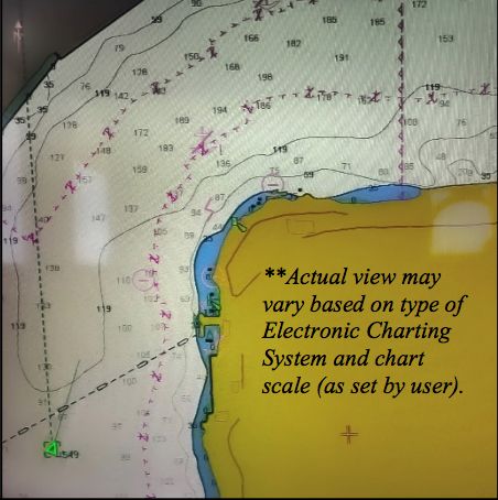
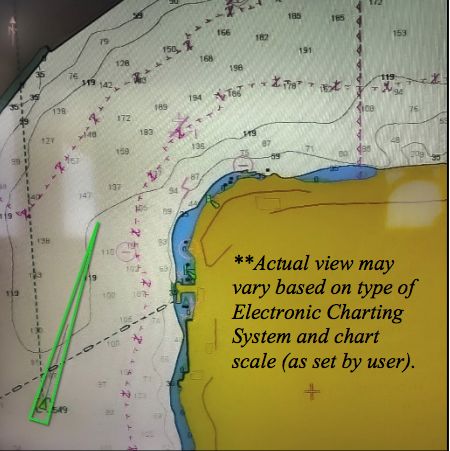
The AIS is a valuable tool, which broadcasts critical vessel information to other vessels on the waterways. However, proper function of the AIS is dependent on accurate vessel data entry, including entering the proper ship type code and the full length of a vessel and its tow. The accurate display of a vessel’s full length becomes particularly important in situations that prevent vessels from seeing each other until they are in very close proximity. The AIS carriage and operating requirements are found in Title 33 Code of Federal Regulations 164.46, which includes a requirement for the accurate input and upkeep of all AIS data fields.
The Coast Guard Navigation Center has produced the AIS Encoding Guide, which provides instructions on how to populate all data fields in AIS, including steps to report the total length of the vessel and the vessel’s tow. Given the wide variety of sizes and lengths of tows, and the heavy density of these types of vessels traveling on the country’s marine transportation system, accurate AIS input is vital to an operator’s ability to make informed navigational decisions.
(Editor’s note: The Coast Guard’s encoding guide is aimed primarily at Class A AIS used by commercial vessels. The coding for Class B AIS commonly used by recreational vessels may not have all the designations. Follow the user’s guide or contact the manufacturer for instructions on inputting your vessel information.)
For more information on setting up and using your AIS, see your manufacturer’s literature as well as the Coast Guard’s Navigation Center, which covers the technology in great detail. Mariners should also be sure to read Practical Sailor’s detailed report on AIS interference to ensure that their system is not subject to the interference that has plagued other sailboats. I discussed the events that prompted that report on AIS interference in a previous blog post on AIS. Practical Sailor has tested a wide range of AIS systems and related equipment. Here is a link to many of those past Practical Sailor reports on AIS.
If you’ve had experiences with mistaken identities using AIS, we’d be interested in hearing them. You can leave comments below, or write to me at practicalsailor@belvoir.com.














I’ve encountered several vessels, more than 10, that their AIS didn’t transmit ANY vessel information other than their MMS number, and manufacturer defaults.
Laziness, lack of knowledge, I don’t know what it is.
Yes, at least you have vessel position, but as this crash shows, there is a big difference between vessel position, and knowing how much room it needs in the channel.
Some of it is the fault of the manufacturer, and the laws covering AIS.
Some types of AIS require a computer, with special software, and adaptors to enter AIS information.
Some the the information may require sending the unit back to the manufacturer, or dealer to reprogram.
None of this equals “ease of use” the motivates a non technical boat operator to re-enter vessel length each time he picks up a tow.
Or a charter operator who just plugged in a required black box into the instrument panel.
AIS works well IF, and only IF both parties take the time to insure it’s settings are correct, and antenna, and splitter are well set up.
At least most vessels enter vessel call sign allowing VHF contact to verify vessel intention.
In a crowded channel with limited visibility this can be crucial for safe passage.
I will have to disagree with assigning any blame to the manufacturer. Especially
“None of this equals “ease of use” the motivates a non technical boat operator to re-enter vessel length each time he picks up a tow.”
The masters of these vessels have huge responsibilities, and must be 100% accountable. If a device requires expert help to set it up properly, then they damn well better pay somebody to do it. Even if they had only set the Vessel Type to 32 (Towing: Length eceeds 200 meters or breadth exceeds 25 meters), semi-permanently, it would have been a safer situation. The same goes for a charter captain. Anybody operating as such is responsible for lives, and they take shortcuts at their peril. Don’t blame the gun manufacturer because you shot yourself in the foot.
What an amazing piece of information you have passed on….being a recreational boater/live aboard I hate to think of the number of recreational boaters who have no knowledge of towing regulations… god forbid , or having to tow or be towed…
Keep up the good work… the more enlightening information the better
I would guess, based on my observation of hundreds of AIS targets over the last few years, that
nearly half of recreational vessels do not have their data programmed correctly. One common error, as mentioned above, is that there is no data at all. Another very common error is in entering vessel dimensions – the AIS is typically entered in meters, and people enter dimensions in feet. This obviously gives ridiculous results, although there is usually no harm done. It is disconcerting to have the 35 foot boat coming toward you show as being 35 meters long on the display – which in a crossing situation at night or in the fog can cause a bit of a panic.
I have a suggestion That the towing vehicle and the towed vehicle be held responsible in that they have all required navigational lights OPERATING while in process and VERY VISIBLE and OBVIOUS to EVERYONE and that THEY BE held responsible for ANY INCIDENT during the process .
I have a suggestion That the towing vehicle and the towed vehicle be held responsible in that they have all required navigational lights OPERATING while in process and VERY VISIBLE and OBVIOUS to EVERYONE and that THEY BE held responsible for ANY INCIDENT during the process .
nav nav nav nav (normal lights)TOWING VEHICLE (FLASHING BRIGHT) (FLASHING BRIGHT) TOWED VEHICLE(normal light)
People died because someone else couldn’t be bothered to be safe
I have a suggestion That the towing vehicle and the towed vehicle be held responsible in that they have all required navigational lights OPERATING while in process and VERY VISIBLE and OBVIOUS to EVERYONE and that THEY BE held responsible for ANY INCIDENT during the process . I also suggest a( DANGER ) light be placed in the center between the towing vehicle and the towed vehicle .
While in the middle of a catamaran race just offshore in Florida I was in a similar situation as far as the idea of things in the water that you can’t see. I was sailing along at about half max speed and I heard a sort of singing sound from under the hull. It was a high pitched sound almost like you might expect from a porpoise or similar, but I could not locate the source right away. This went on for about a minute and I decided to slow the boat down to see if the sound would change pitch. – It did but if I speeded up again it would come back just as before. So I decided to pull up my daggerboards to see if I was snagged on something. The port side board was fine, and the rudders were fine, but the starboard daggerboard was almost cut in half by a single piece of fishing line. I never did see exactly what boat it was from, but it had to be sawing it’s way thru my daggerboard with water cooled efficiency for several minutes. At this race, there were boats of every description of all sizes moving in N-S or S-N directions very close to the race course. I’m just glad I wasn’t in the water scuba diving or anything like that. Needless to say the daggerboard could not be saved. A couple of weeks later in another race I hit a fishing net that had been wound into a solid ball about 3 feet in diameter. It had to weigh several hundred pounds because it was mostly stainless steel mesh. But it floated just under the surface of the choppy water and it was invisible to us until we slammed into it at full speed. My crew was knocked overboard, but thankfully was on the trap wire at the time or I would have had to go retrieve her.
I have been informed that a powered vessel towing does not have R/W privileges over other vessels unless it considers its maneuverability limited, in which case it must display RWR lights or dayshapes. This information has come to me from other skippers who have changed course to avoid a tug towing barges behind and then being chastised by the tug for not maintaining course. The tug did not consider itself burdened and had already changed course.
IMHO it would make more sense for a tow, if showing lights/shapes as a tow, stand on. Any comments??
AIS is a tool that is great for collision avoidance.
It does not replace a lookout – that means looking out!
Trusting electronic devices rather than an active lookout is a fools game.
It is incumbent on boaters transiting commercial waters to have a working knowledge of COLREG Lights for Vessels that might be in the vicinity of their vessel. Recreational mariners should not expect a commercial vessel to treat them differently than any other vessel at sea.
We often hear of sailors (especially racers) expecting commercial traffic to change course when they are approaching.
Remember that vessels with restricted manuverability have the right of way!
When i used to fly at night, I marked special information on navigational charts with fluorescent markers. I used a battery powered black light to read them
This did not affect my night vision
I *love* Sara’s idea of using a fluorescent marker! Is this something easily purchased (ie: Staples, etc.?)
Keep up the good work!
– Jack
Finestkind Marine